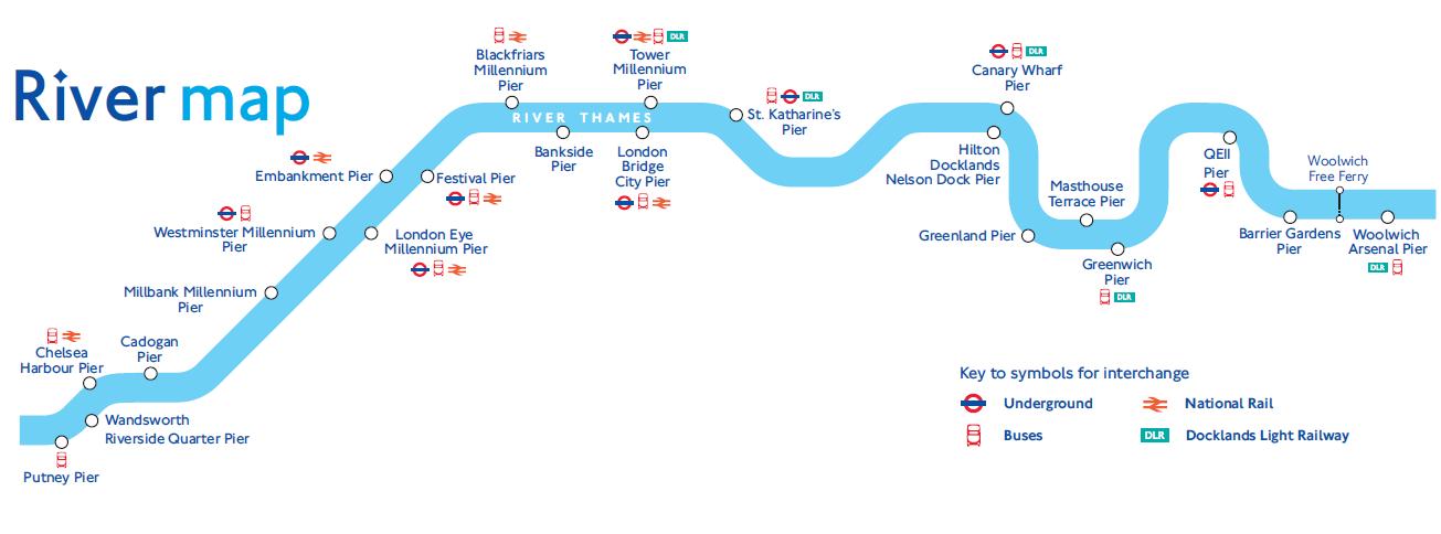
River Thames Transport Map
Navigating the River Thames can be confusing, with piers, underground stations, busses, national rail and docklands light railway services to take into accout. The map below simpy shows the location of these five elements in relation to the River Thames, so you can see simply where everything is located and how to navigate to each pier.
Reviews
Just a note to thank you so much for the tasty food you served, everybody were happy and enjoyed the lunch.


